The scenic drive
Maryland DNR's self-guided tour: 44 miles and about 3 hours on the forest's roads, from headquarters past the overlooks, the old orchard ground, the Potomac and the camps, back to where you started.
31 stops, by odometer mile from the stop sign at the end of Forest Court. DNR's own guide (PDF).
Mostly gravel forest roads. Check conditions with headquarters (301-478-3124) before you set out; a few stops are listed but could not be placed on the map.
-
1Mile 0
Forest Court stop sign
Turn
Leave headquarters, stop at the end of Forest Court and zero your trip odometer. Turn left onto M.V. Smith Road. Most of the forest around you is second-growth oak about a century old, regrown after the Mertens orchard failed.
-
2Mile 1.8
US 40 Scenic
Turn
Turn right at the stop sign onto US 40 Scenic, the old National Road. Just before the junction, look right for Town Hill and a recent timber harvest you will pass again at the end.
-
3Mile 4.3
Town Hill Vista
Overlook
Pull into the parking area on the right, across from the Town Hill Motel. Get out: Sideling Hill and the I-68 cut lie to the east, and the Beauty Spot of Maryland wayside covers the National Road. Leave by Tower Road, the dirt road out the back of the lot.
-
4Mile 4.9
Town Hill Fire Tower
sight
On the left, among modern communication masts, is the 1931 fire tower. Rangers sat 8 to 12 hour shifts up there in fire season, fixing smoke by compass and triangulating with other towers, until aircraft and radios retired the towers in the 1970s.
-
5Mile 6
Variable retention harvest
sight
On the left is a stand cut in autumn 2007 to regenerate it. Most trees over two inches were taken, but islands of old trees were left for wildlife and structure; the dense young growth is the new stand coming in. About 250 acres a year are managed this way across the forest.
-
6Mile 7.3
I-68 bridge
Turn
Bear right to cross the bridge over I-68, then at 7.4 turn left onto Mountain Road immediately after it. Fall colour here peaks in the second to fourth week of October.
-
7Mile 9
Mud Lick culvert
sight
The culvert carries Mud Lick into Fifteen Mile Creek. The bottomland here grows sycamore, white ash, tulip poplar, elm and pawpaw on the deeper floodplain soil.
-
8Mile 9.2
Fifteen Mile Creek and campsite 82
sight
Bear left to stay on Mountain Road. Fifteen Mile Creek and site 82 are on your right, one of roughly 100 primitive sites in the forest, each just a table and a fire ring.
-
9Mile 10.1
Stay on Mountain Road
Turn
Bear right to remain on Mountain Road.
-
10Mile 10.6
Orleans Road
Turn
At the stop sign, turn right onto Orleans Road.
-
11Mile 12.8
Keep right (Bill's Place is left)
Turn
Continue to the right. The road on the left drops to Bill's Place in Little Orleans and the C&O Canal.
-
12Mile 13
Low-water bridge, Oldtown Orleans Road
Turn
Cross the low-water bridge over Fifteen Mile Creek and turn right onto Oldtown Orleans Road. Do not attempt the bridge when the creek is high.
-
13Mile 15.8
Carroll Road
Turn
Turn left onto Carroll Road.
-
14Mile 16
Point Lookout Overlook
Overlook
Park in the lot on the right. Union soldiers used this 900 ft point as a signal post; the Potomac is 300 ft below in a loop once called General Washington's Horseshoe Bend, with the canal on the Maryland bank. The stunted red cedars on the slope below are up to 350 years old, growing on a shale barren in the driest corner of Maryland. Turn around here.
-
15Mile 16.2
Back to Oldtown Orleans Road
Turn
At the stop sign turn left onto Oldtown Orleans Road.
-
16Mile 19.2
Brinkman-Rine Cemetery
sight
On the right is one of more than 30 family cemeteries documented in the forest. The woods on both sides were thinned in 2010; this stand grew back from the forest's first commercial clear-cut, 200 acres in 1969.
-
17Mile 19.5
Mertens Avenue
Turn
Turn right onto Mertens Avenue. At 19.9 a remnant old-growth stand is on the left: multi-layered canopy, big standing and fallen dead wood, pit-and-mound ground. Pull off and walk in if you like.
-
18Mile 20.7
Banner's Overlook
Overlook
Park in the lot on the left. Looking east from Town Hill over the Potomac to West Virginia; the forest has about 30 miles of river shoreline, and the two-day canoe float from Paw Paw to Bonds Landing to Fifteen Mile Creek runs below you. The slope beneath the overlook regrew on its own after a 200-acre wildfire in 1991. Return to Mertens Avenue and continue west.
-
19Mile 22.6
Green Ridge Road
Turn
Turn left onto Green Ridge Road.
-
20Mile 24.9
Log Roll Overlook
Overlook
Pull into the lot on the right. The overlook faces west over Town Creek; in the clearing era logs were dumped over this edge and floated nine miles downstream at high water to a sawmill by the canal. Turn around and head back north.
-
21Mile 26.6
Jacobs Road
Turn
Turn left onto Jacobs Road. Five native pines grow in this forest (white, Virginia, pitch, shortleaf and table-mountain) along with hemlock and red cedar; they are the winter cover for much of its wildlife.
-
22Mile 29.5
Maple Run bridge
sight
Cross the small bridge over Maple Run. Everything on the right of Jacobs Road from here to Twigg Road is the 2,760-acre Maple Run Wildland.
-
23Mile 33.6
Mertens Avenue again
Turn
Turn left onto Mertens Avenue.
-
24Mile 34.2
Troutman Road
Turn
Turn right onto Troutman Road. At 35.3 the road passes a sugar maple grove on richer soil, a northern hardwood pocket that is the forest's best fall colour.
-
25Mile 35.7
Zumbrun Overlook
Overlook
Pull off on the right. Across the road, follow the pink-blazed Mountain Bike Trail up the ridge about 250 yards to a clearing on the right: Polish Mountain to the west, the Town Creek basin, Warrior Mountain and Flintstone. Named for Champ Zumbrun, forest manager 1978 to 2009. The Great Eastern Trail leaves the bike loop here on its way down to Flintstone.
-
26Mile 36.6
Gilpin Road
Turn
To end early, turn left onto Gilpin Road toward Flintstone and I-68. To finish the loop, turn right onto Gilpin Road.
-
27Mile 36.9
MD 144 East
Turn
Turn right at the stop sign onto MD 144 East.
-
28Mile 40.7
US 40 Scenic
Turn
Turn left at the stop sign onto US 40 Scenic and cross the bridge over Fifteen Mile Creek at 40.8.
-
29Mile 41.9
Shooting range
sight
On the right is the forest shooting range, paid for by hunting licence fees. Daily and annual permits are sold only at headquarters, and the range closes for police and hunter-safety training.
-
30Mile 42.2
M.V. Smith Road
Turn
Take a sharp right back onto M.V. Smith Road. Town Hill and the variable retention harvest from the start of the tour are on the left.
-
31Mile 44.1
Headquarters
Stop
Turn right onto Forest Court and follow it back to headquarters. End of tour.
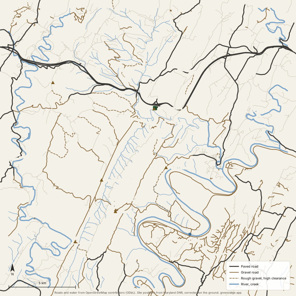
Route drawn over OpenStreetMap roads (ODbL) between the stops in DNR's guide; stop positions from the app's road data. Filled circles are overlooks. The campsite map · The 3D map in the app.