The shape of this forest is the reason for everything else in it: which slope holds water, which ridge takes the morning, where the road has to switchback. It is also older than nearly anything else you can stand on.
Booking
None. Sites are first come, first served.
Fee
$10 a night for a standard site, $20 for a group site, paid at headquarters. Maryland DNR.
Check in
Sign the sheet at headquarters when you arrive, then go to the site.
Is it free tonight?
This page cannot know. The app shows what the sign-up sheet last showed, with the photo's age.
Every photograph here is openly licensed and credited to the person who took it.
The recordings are in the app — open the nature
guide to hear them.
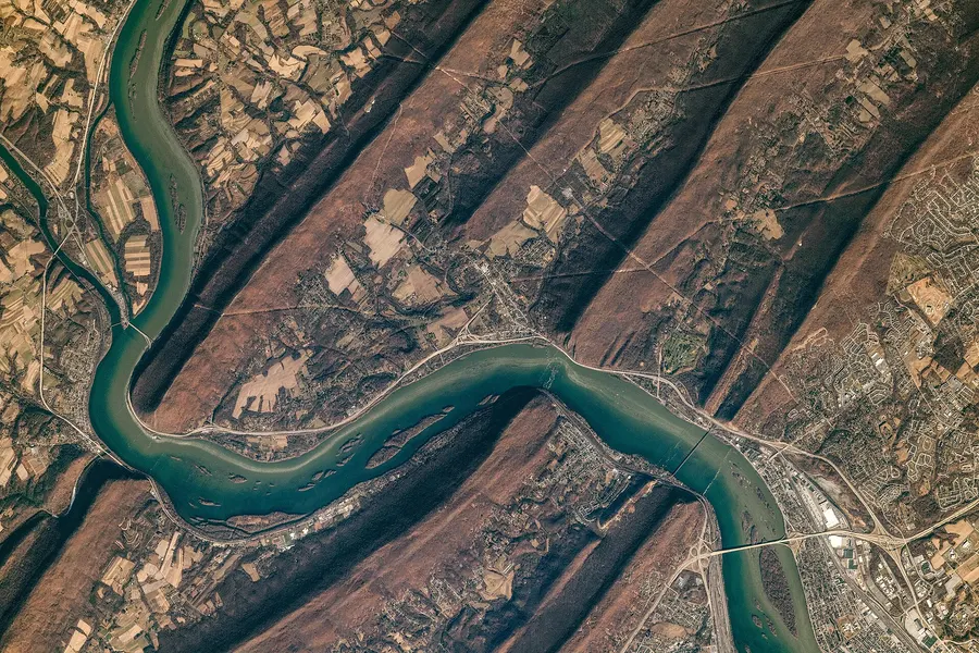
Look at any map of this forest and you'll see long parallel ridges (Sideling Hill, Town Hill, Green Ridge, Polish Mountain) all running northeast to southwest like corduroy. That's not a coincidence; it's the Ridge and Valley province.
Around 300 million years ago, Africa slow-crashed into North America and rumpled this whole region like a rug shoved against a wall. Erosion has been picking at the rumples ever since. Hard sandstone layers held up as ridges; soft shale wore down into the valleys between. The stripes are the roots of mountains that once stood Himalaya-tall.
When it formed
Folded ~300 million years ago
Where to see it
Any overlook. From Point Lookout or Banners Overlook you can count the parallel ridges marching to the horizon into West Virginia and Pennsylvania.
The ridge the forest is named for holds its height because it's capped by tough sandstone of the Foreknobs Formation: the leftover edge of a huge downward rock fold (a syncline) whose middle eroded away.
Counterintuitive but true across the Appalachians: today's ridgetops are often the bottoms of ancient folds. The rock that got bent downward was squeezed hardest, resisted erosion best, and got left standing when everything above it washed away. You're camping on the durable wreckage of a fold.
When it formed
Devonian sandstone, ~375 million years old
Where to see it
The ridge under your feet on the high campsites; roadcuts along Green Ridge Road show the tilted sandstone layers.
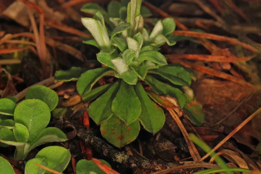
Steep, bare, south-facing slopes of loose gray-black rock chips where the forest just… gives up. Ground temperatures on a summer afternoon can pass 130°F. And yet things live here that live nowhere else on Earth.
The Brallier shale crumbles faster than soil can form on it, so the slope stays a hot, dry, sliding pile of rock flakes. Most plants can't cope. A handful of specialists evolved to cope with nothing else: shale-barren evening primrose, shale-barren pussytoes, Kate's Mountain clover. Botanists travel across the country to see slopes you can walk past on the way to your campsite. Stay to the edges, because a footprint here lasts years.
When it formed
Devonian Brallier shale, still crumbling
Where to see it
South- and west-facing slopes along the Potomac bends and lower Fifteenmile Creek. Look for open gray slopes with scattered scrubby pine and redcedar.
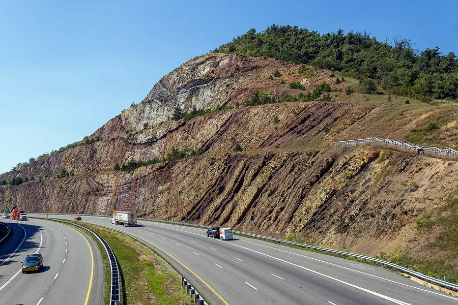
Twenty minutes east on I-68, engineers blasted a 340-foot-deep notch through Sideling Hill and accidentally created one of the best geology exposures in the eastern U.S.: 800-plus feet of rock layers folded into a giant U you can read like a cross-section diagram.
The U shape is a syncline, the same kind of downward fold that explains why Green Ridge itself stands. Here you can actually see one, whole, in a single glance: the layers dive down both sides and meet at the bottom. It's the diagram from every geology textbook, rendered at highway scale.
When it formed
Rocks ~350 million years old, cut open in 1984
Where to see it
I-68 at the Washington/Allegany county line, 20 minutes east of the forest. Park at the exit 77 area and walk toward the cut. Worth the detour on your drive in or out.
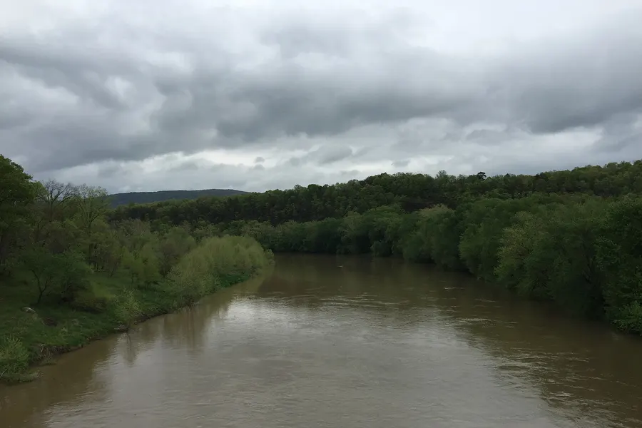
South of the forest, the Potomac ties itself in knots: a series of huge horseshoe loops carved hundreds of feet down into solid rock, doubling back so hard that six miles of river progress takes almost thirty by water.
The river meandered lazily across a flat plain long ago. Then the land slowly rose beneath it, and the river, too big to be pushed around, kept its curves and sawed straight down into bedrock. The result is called an incised meander, and the Paw Paw bends are a textbook set. Canal engineers found them so maddening they dug a 3,118-foot tunnel rather than follow four of them — that story has its own chapter in The story tab.
When it formed
The river is older than the mountains it cuts
Where to see it
Float it (the GRSF river campsites sit right on the bends), or look down on the loops from the high southern overlooks.
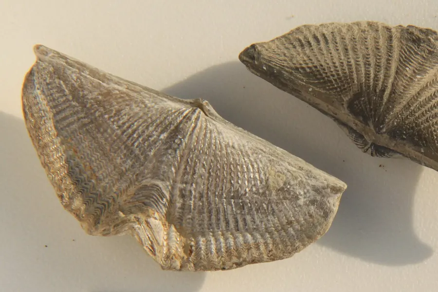
The sandstones and shales of this forest are hardened mud and sand from the floor of a shallow tropical sea, laid down when this patch of crust sat south of the equator. Split rocks here sometimes show seashells: brachiopods, ancient clam-like animals in ribbed half-moon shells.
Before the continents collided and raised mountains, a broad inland sea covered this region for tens of millions of years, catching sediment washed off highlands to the east. Every ledge you scramble is stacked seafloor. Finding a brachiopod in a creek cobble means holding an animal that died 375 million years before the first dinosaur.
When it formed
Devonian period, ~375 million years ago
Where to see it
Loose rock in creek beds and old roadcuts. Look, photograph, and leave them. Collecting isn't allowed on the state forest, and the next camper deserves the same find.
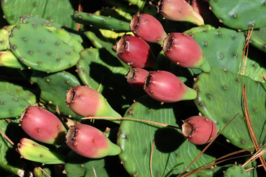
Green Ridge gets around 36 inches of rain a year, the least in Maryland and noticeably less than Baltimore. It's the reason this forest feels different: open oak woods, pine ridges, crunchy leaf litter, even a native cactus.
Storms rolling in from the west climb the Allegheny Front and wring themselves out over Garrett County, which gets nearly a foot and a half more rain. By the time the air slides down into these ridges it's been squeezed half-dry — a rain shadow. Dry climate plus water-shedding shale makes the driest, most desert-adjacent forest in the state, which is exactly why prickly pear, fence lizards, and the shale-barren endemics call it home.
When it formed
As long as the mountains have stood
Where to see it
Everywhere; it's the character of the whole forest. Compare the crackling dry ridgetops here with the mossy rainforest feel of Swallow Falls two counties west.
The forest's spine of cold, clear water. The creek had the nerve to cut straight across the grain of the ridges on its way to the Potomac, sawing out the shaded gorge the campsites line.
Water always wins eventually. Fifteenmile Creek held its course while the land rose, slicing down through ridge rock rather than detouring around it. The reward for campers: deep-shaded bends, swimming holes against bedrock walls, and the coolest air in the forest on an August afternoon.
When it formed
Carving continuously since the ridges rose
Where to see it
The Fifteenmile Creek camping loops; the C&O Canal aqueduct where the creek meets the Potomac at Little Orleans.
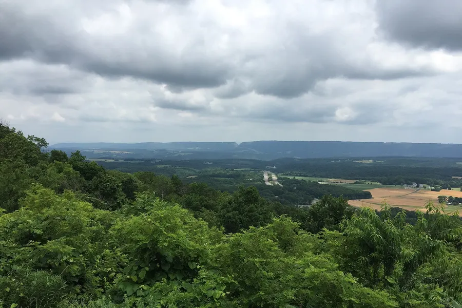
From Point Lookout or Banners Overlook you can see the whole geology lesson at once: ridge after parallel ridge fading blue toward West Virginia, with the Potomac glinting in the gaps.
Each ridge you count is a resistant rock layer; each valley between is a softer one. The evenness of the ridgeline heights isn't an accident either: they're remnants of a single old land surface, since dissected by rivers. Sunset does the geology the most justice.
When it formed
A 300-million-year view
Where to see it
Point Lookout (off the scenic overlook spur near I-68) and Banners Overlook along the forest's driving tour. Both drivable, both free.
The same geology that makes this forest dry and thin-soiled convinced a Cumberland family it was perfect orchard country: well-drained shaley loam, sunny slopes, and frost that drains off the hillsides on cold nights.
They weren't entirely wrong: apples genuinely like drained slopes and dry autumns. But what the shale gave, it took back. The soils were too lean and droughty to sustain a commercial empire, 'the largest apple orchard in the universe' went bankrupt by 1918, and the forest you're camping in grew up through the abandoned rows. The full saga lives in The story tab.
When it formed
Geology writing history, ~1900
Where to see it
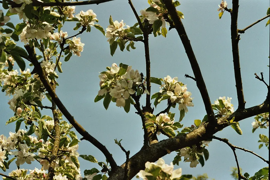
Feral apple trees still bloom white along old lanes in a few corners of the forest every April, century-old survivors of the scheme.
On the hot south-facing shale slopes the oaks give out and the pines take over: scruffy pitch pines with bark like armour, Virginia pines, and on Point Lookout's slope eastern red cedars that have stood there for up to 350 years while staying stunted by the thin ground. Green Ridge has five native pines (white, Virginia, pitch, shortleaf and table-mountain) plus hemlock and red cedar, and the driest climate of any Maryland state forest: under 36 inches of rain a year in the rain shadow of the Allegheny Plateau, against 47 inches just west in Garrett County.
Pitch pine is built for wildfire. Its thick bark shrugs off ground fire, it can resprout from the trunk if the crown burns, and many of its cones stay sealed with resin until heat opens them, so a burn is exactly when it seeds. The hardwoods it competes with cannot do any of that, so every fire that sweeps a barren resets the contest in the pines' favour. Take fire away and the oaks slowly win; that is why foresters here treat fire as part of the ecosystem rather than only as an enemy.
When it formed
Shale barrens today, shaped by fire
Where to see it
Look down from Point Lookout at the cedars on the slope below the platform, or from Banner's Overlook at the hillside that regrew naturally after a 200-acre wildfire in 1991. The Deep Run/Big Run Trail crosses the barrens on foot.
_lrg.jpg)
.jpg)


_between_Paw_Paw,_Morgan_County,_West_Virginia_and_Allegany_County,_Maryland.jpg)

_and_beyond_towards_Sideling_Hill_from_the_Town_Hill_Overlook_on_Town_Hill_in_eastern_Allegany_County,_Maryland.jpg)
