This forest was clear-cut, then planted as the largest apple orchard in the eastern United States, then abandoned, then replanted. Almost none of what you walk through is old growth, and the evidence of all of it is still on the ground.
Booking
None. Sites are first come, first served.
Fee
$10 a night for a standard site, $20 for a group site, paid at headquarters. Maryland DNR.
Check in
Sign the sheet at headquarters when you arrive, then go to the site.
Is it free tonight?
This page cannot know. The app shows what the sign-up sheet last showed, with the photo's age.
Every photograph here is openly licensed and credited to the person who took it.
The recordings are in the app — open the nature
guide to hear them.
The Potomac corridor below this forest was a highway long before it was a border, part of the great north–south trail network native nations used between the Iroquois country and the south. A Shawnee town stood at the river ford the colonists would later call Oldtown. The ridges were hunting ground; the river gaps were the way through.
When
Long before 1700
What is left to see
The geography still teaches it: every road, canal, and rail line that came later squeezed through the same water gaps the footpaths used first.
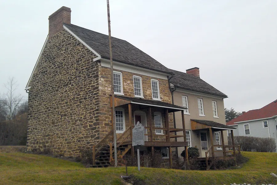
Frontier trader Thomas Cresap planted his fortified homestead at the old Shawnee town site in the 1740s, and a young George Washington stopped here surveying in 1748. His son Michael's stone house, built about 1764, still stands in Oldtown at the forest's southwest edge, one of the oldest buildings in western Maryland.
When
1740s–1790s
What is left to see
The Michael Cresap House in Oldtown, minutes from the forest's southern campsites. While you're there, cross Oldtown's little low-water toll bridge to West Virginia, one of the last privately owned toll bridges in America.
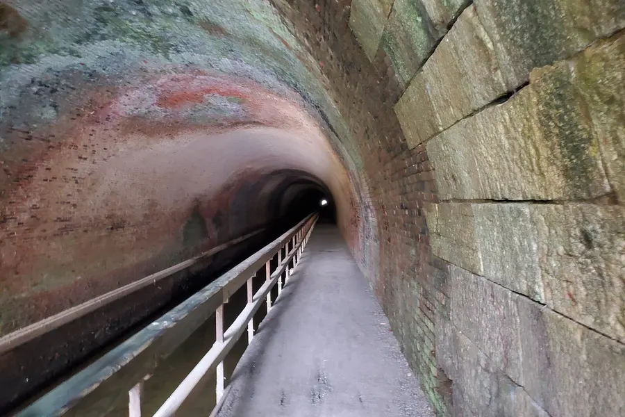
Rather than follow the Potomac around four monstrous bends, the C&O Canal Company decided to bore straight through the ridge: 3,118 feet of tunnel, lined with millions of bricks, dug by hand by immigrant crews (largely Irish) through wage disputes and outright labor riots. Budgeted at two years, it consumed fourteen and helped exhaust the company.
When
1836–1850
What is left to see
Walk it. The tunnel is a short drive from the forest's river sites at Paw Paw, WV. Bring a flashlight; the towpath through is dark, dripping, and unforgettable, and the boardwalk grooves still show towrope wear.
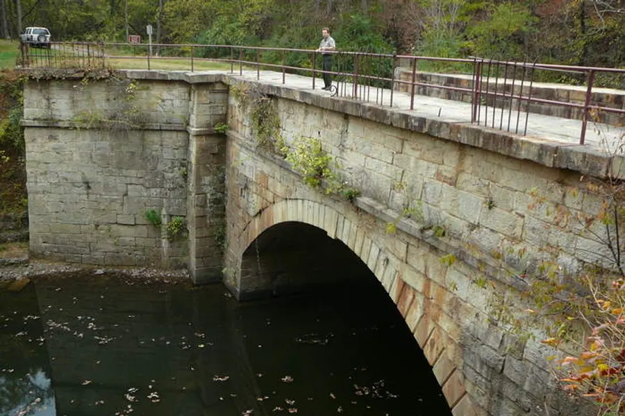
For seventy years, mule-drawn boats hauling Cumberland coal slid past the mouth of Fifteenmile Creek, where the stone aqueduct carried the canal over the water and the hamlet of Little Orleans kept the boatmen fed. The 1924 flood ended canal commerce for good; the towpath is now the C&O Canal National Historical Park.
When
1850–1924
What is left to see
The Fifteenmile Creek aqueduct at Little Orleans, right at the forest's edge. The towpath makes a flat, shady walk or ride from the campsites along the creek.
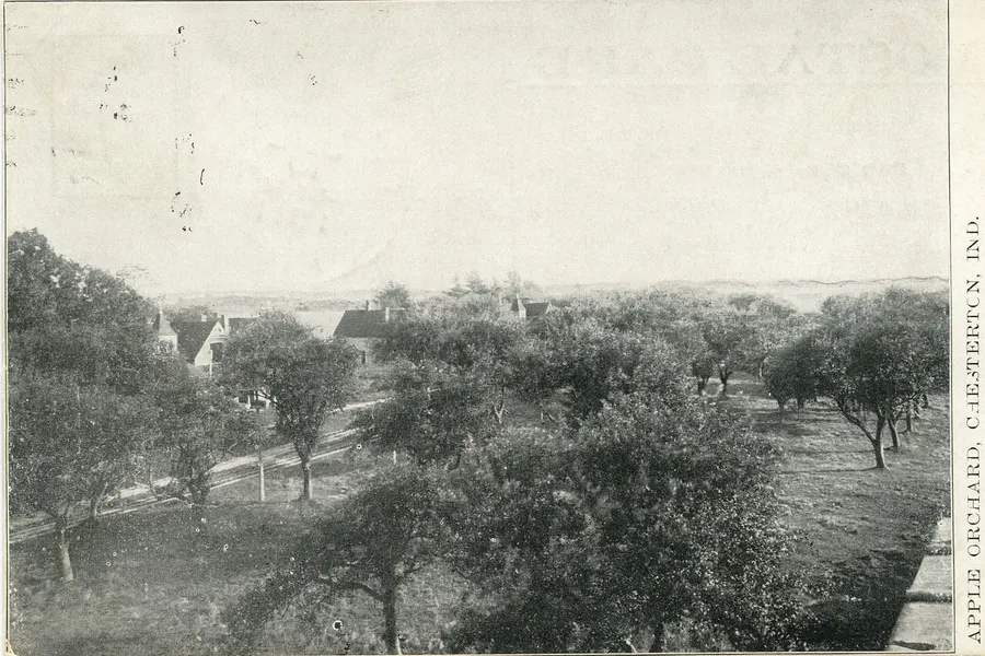
Around 1900 the Merten family of Cumberland bought up this ridge country, cleared enormous swaths of it, and marketed it, with zero modesty, as 'the largest apple orchard in the universe.' They carved the land into some 3,000 ten-acre lots and sold them to buyers across the country who'd never seen the thin shale soil their deeds described. By 1918 the scheme was bankrupt, the lots abandoned, the hills stripped.
When
~1900–1918
What is left to see
You're camping in the aftermath: nearly every tree at GRSF is younger than the bankruptcy. A few feral apple trees still bloom along old lanes each April.
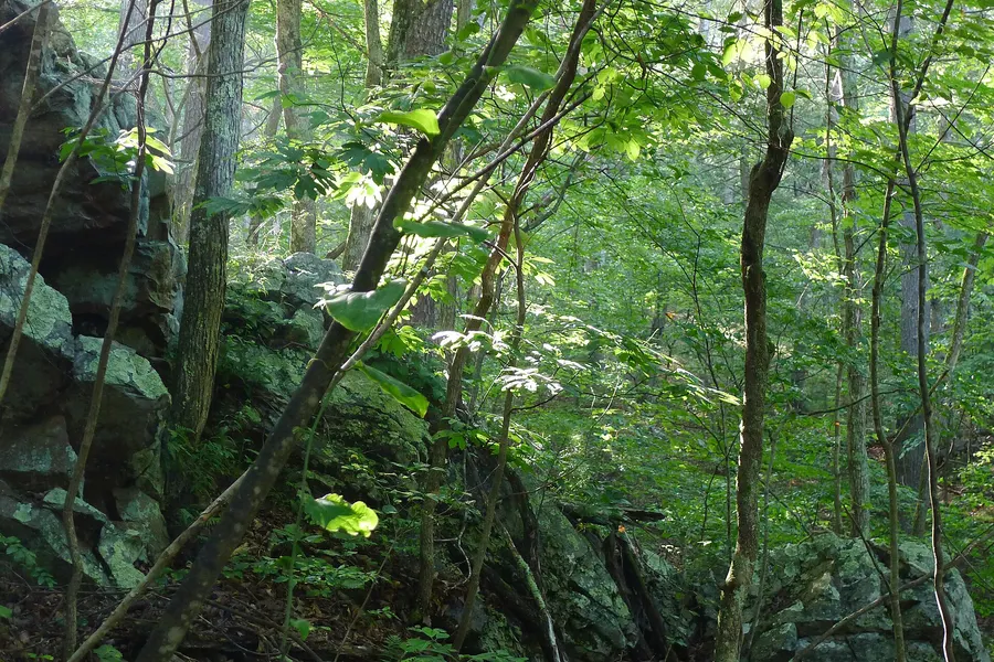
In 1931 the State of Maryland bought roughly 2,000 acres of the failed orchard lands, cut-over, burned-over, and cheap, as the seed of a state forest. Piece by tax-sale piece it grew to today's ~49,000 acres, Maryland's second-largest public land. The 'wilderness' you're enjoying is a century-old comeback story still in progress.
When
1931 → today
What is left to see
The even-aged oak woods themselves: whole hillsides of trees the same size, all dating from the same abandonment.
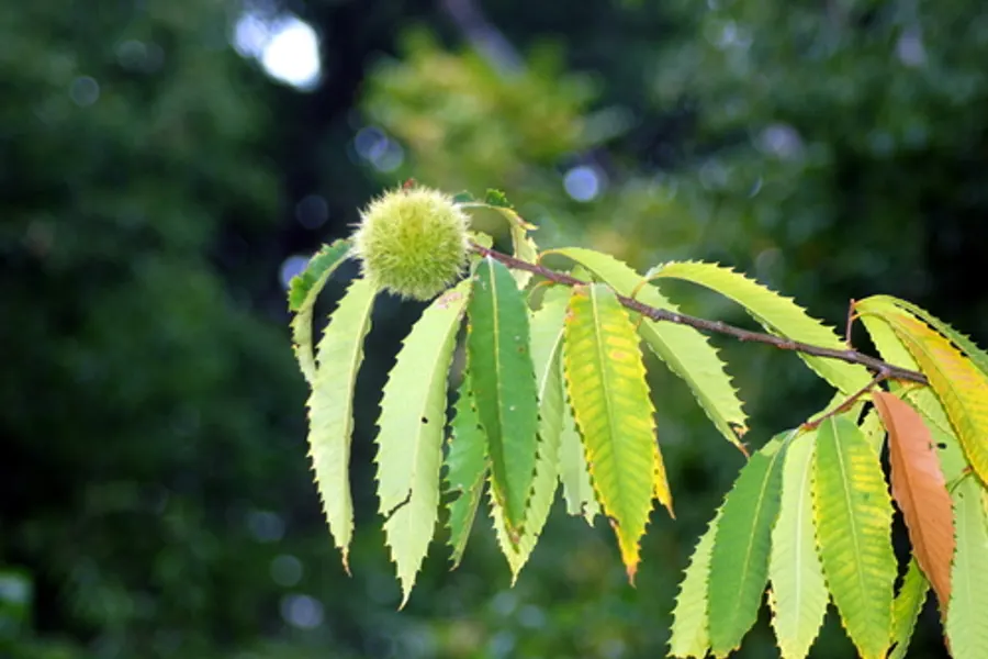
While the apple scheme collapsed, a quieter catastrophe ran through what forest remained. Chestnut blight, an imported fungus, killed essentially every mature American chestnut, a tree that had been a quarter of the eastern forest and fed everything from bears to hogs to families. The forest that regrew here is an oak forest partly because the chestnuts never could.
When
1910s–1930s
What is left to see
Chestnut stump sprouts still rise and die back on the dry ridges. Find them in the See tab and you're looking at living ghosts of the old forest.
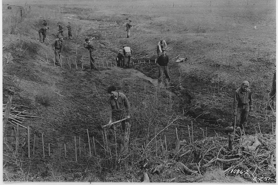
The Civilian Conservation Corps put Depression-era young men to work rebuilding this land: planting, fighting fires, and cutting the roads and trails campers still drive. Camp Green Ridge near Flintstone housed Company 335-C, one of the CCC's segregated African-American companies, over a hundred men strong; a second camp worked the Paw Paw end of the forest. Much of the forest's bone structure is their work.
When
1933–1942
What is left to see
Every graded forest road and many trail alignments. Their labor is the infrastructure itself.
In 1906 the Western Maryland Railway drove its Cumberland extension along the Potomac right below the forest, a big-engineering line of cuts, fills, and tunnels built to out-haul the older B&O across the river. It lasted until 1975, when the merged Chessie System shut it down. Freight still rumbles the West Virginia bank on the old B&O, and that's the train you hear at night from the river sites.
When
1906–1975
What is left to see
The abandoned WM grade and its tunnels near the Paw Paw bends. Indigo Tunnel is gated off; it's now one of the region's most important bat hibernation sites, which feels like a fair retirement.
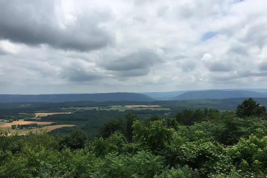
The orchard company's showplace stood at Point Lookout, where the view sold ten-acre dreams to out-of-state buyers. The enterprise is a century gone; the view is doing fine. The state kept the overlook, and the sunset from it remains the best free thing in Allegany County.
When
1900s → today
What is left to see
Point Lookout overlook, an easy drive from the forest's northern campsites. Bring dinner and watch the ridges go blue.
A sawmill chimney and the largest orchard in the world
orchard
In the early 1800s most of what is now Green Ridge belonged to the Carroll family interests (DNR's current page names Richard Caton and William Carroll and their Town Hill Mining, Manufacturing and Timber Company; the older visitor guide credits Charles Carroll of Carrollton, the last surviving signer of the Declaration of Independence). Their steam-powered sawmill of 1836 is gone except for its brick chimney, the one structure left from that era. In the 1870s Frederick Mertens, a German immigrant who had come to Cumberland to build canal boats, bought more than 30,000 acres from the Carroll heirs. After his death his sons cleared and burned thousands of acres to plant apples, selling the scheme as the largest orchard in the world. It went bankrupt in 1917 (1918 by DNR's other telling), and in 1931 the state bought the worn-out land for a forest.
When
1836–1918
What is left to see
The Carroll Chimney stands alone in the woods; ask at headquarters for directions and leave it exactly as you find it. Feral apple trees still blossom along old lanes every April.
Three Civilian Conservation Corps camps worked Green Ridge in the 1930s, mostly on fire control but also building the roads, trails and picnic spots you still use. When the CCC disbanded, the camp beside Fifteen Mile Creek got a second life: during the Second World War it held German prisoners of war, who were put to work cutting pulpwood and doing farm labour in the valley. In 1955 the same ground became Green Ridge Youth Camp, which ran until it was abandoned in the 1990s. The buildings are all that is left of all three chapters.
When
1930s–1990s
What is left to see
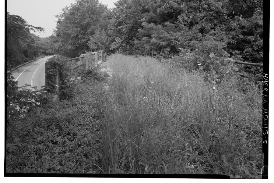
The old camp buildings near Fifteen Mile Creek, passed on the driving tour just after the Maple Run bridge on Jacobs Road. They are closed; look from the road.


.jpg)
.jpg)

